 Start with the first 'Moab, Lake Powell, Grand Canyon, Durango' entry at the bottom. I'm sleepy. I'll write & post more tomorrow or Wed.
Monday, June 20, 2011
Moab, Lake Powell, Grand Canyon, Durango
Start with the first 'Moab, Lake Powell, Grand Canyon, Durango' entry at the bottom. I'm sleepy. I'll write & post more tomorrow or Wed.
Moab, Lake Powell, Grand Canyon, Durango
 Drove past this scene 3 times to get this picture. Two cops talking with some dude towing an airplane east bound between 4 Corners & Cortez. I like to imagine what they are saying...
 Graffitied trailer between Cortez & Durango?
  Stopped in Durango for the night to visit a friend, Ryan, eat sushi, drink beers, take a bath, and watch another disappointing Woody Allen film.
The next morning he took me to a hot springs. The perfect ending to a 6 day, 5 nights sleeping in the forester, hiking in the desert, road trip.

Moab, Lake Powell, Grand Canyon, Durango
 The landscaped changed so much though out my trip. I was surprised to see evergreen forest around Jacob Lake just north of the Grand Canyon.
  Jacob told me about the trails. I chose North Kiabab. He said is was the hardest. I only hiked about 2 miles of it. It's the trail people take to hike Rim to Rim, from the North Rim to the South or vice versa. It's 14 miles from the top of the North Rim to the bottom of the canyon. There's no way, not in one day anyway. Hiking up is so hard.
  The trail was really powdery and we shared it with people on mules. So it was poopy too.
  Here it is- the Grand Canyon. I made it. Very Cool. And Big.
Moab, Lake Powell, Grand Canyon, Durango
Can't take a bad picture in Antelope Canyon, on the other side of Page, AZ, from Lake Powell. It's in the Navajo Nation. They drive you 3 miles out to it, then a guide takes you through, not because it's dangerous- it was all level ground and shaded (it's a slot canyon)- to keep the traffic moving through. I took so many pictures. I could make 4+ calendars.


 Lake Powell & Wahweap campgrounds
 Next morn in the bathroom- very clean- before hitting the road south to the North Rim. My hair kept getting taller.
 Moab, Lake Powell, Grand Canyon, Durango

 Nice cool morning south of Moab, hwy 191.
 Hot desperate afternoon just south of Mexican Hat, hwy 191. On my way to Lake Powell.
 Moab, Lake Powell, Grand Canyon, Durango
Few more pics of Aches National Park.
 Dude got his girlfriend in the picture too.
 Too bad the colors are a bit washed out. A view from the nothing-but-rock section of the Delicate Arch Trail.
  Found some shade... and a Middle Eastern tourist to take my picture.
 My glove compartment/toiletry bag.
 Moab, Lake Powell, Grand Canyon, Durango
 The morning after my first night in Moab I decided to hike in Arches National Park, just off 191. I chose the Delicate Arch Trail. This is the Delicate Arch, the trail's mecca and namesake. This arch is on Utah's license plate, the unofficial symbol of UT I heard.
  The sun was intense. Many children whined. And my car had to have been 200 degrees after my 3 hour hike. I needed to find a swimming hole and fast. So somebody told me of the creek just south of downtown Moab. It was cold and cloudy with dirt, and just what I needed. There I met these wonderful women, again from Quebec, Sophie and Julie. They had been to Moab twice before and love the biking trails.
  Julie made the veggies and pasta, and I grilled corn on the cob. They stayed with me on my campsite, the one a snagged first thing in the morning before hiking, because it was Friday and there were no open spots for them. So I paid it forward. I was happy to have them, they were fun company.
  Julie dropped the pasta on the ground. We ate it, and no one found grit.
 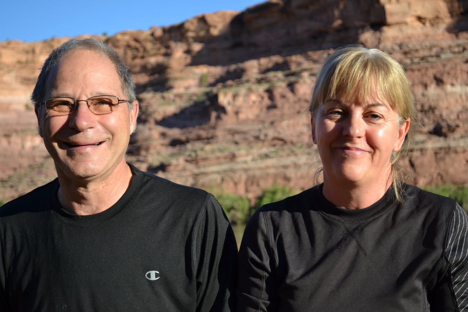 This is Chantal and Serge, the couple that let me crash with them the first night. I did not ask them to wear matching black shirts.
Moab, Lake Powell, Grand Canyon, Durango
Two weeks ago a had 6 days off, so I drove to the Grand Canyon, AZ- one of my summer goals. The night before I left, my housemate told me Moab, UT, was "awesome". Since it was on my way I stopped there too and spent 2 nights. After 3 days in the desert a craved big water, so I stopped, swam, slept at Lake Powell, AZ, for one night. It was also on my way. On route, after listening to people talk, I decided to visit the North Rim of the Grand Canyon because the South Rim is another 200 miles and more touristy. I haven't yet added up all the miles. Initially I found my route on mapquest and altered it as advised and shown on paper maps. It was nice to shut down GPS for the week after relying on it so heavily finding my way around Denver.
I saw every place I wanted to see all thanks to my Silver Steed, my '02 Forester, which I bought as a rebuilt title, thank you very much, last fall. I got a great deal. What a fucking good find. She's taken me to Savannah, Charleston, Chicago, and Ft. Wayne, IN, to Denver. That desert was brutal. My car took me there so I could see for myself, and then she carried me back.
 This was my face when I saw my first eye full of Moab... at sunset no less. Fuckin Moab. Gorgeous! I've never seen a more beautiful collage of red and green, and lots of other colors too.
 I drove west on 70 across CO then just inside UT I cut south on 191. This was taken very soon after my redirection, just north of Moab.
  The Colorado River
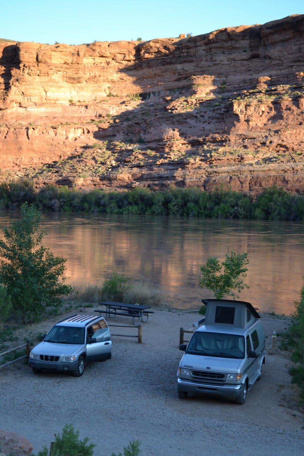 The campsite I shared with generous couple from Quebec on the bank of the Colorado River. There were no vacant campsites, and when I stopped to ask how to reserve one, they invited me to stay and eat their food. I didn't eat their food but I did ask them to take a picture of me brushing my teeth.
Wednesday, June 1, 2011


Subscribe to:
Comments (Atom)